DEVICES · NOETIC CONSOLE

NOETIC Console Gradiometer

Two magnetometers on a 50 cm vertical baseline measure the gradient of the magnetic field beneath your feet. The field console shows the result live, guides you by voice and on screen, and sends every scan to your phone.

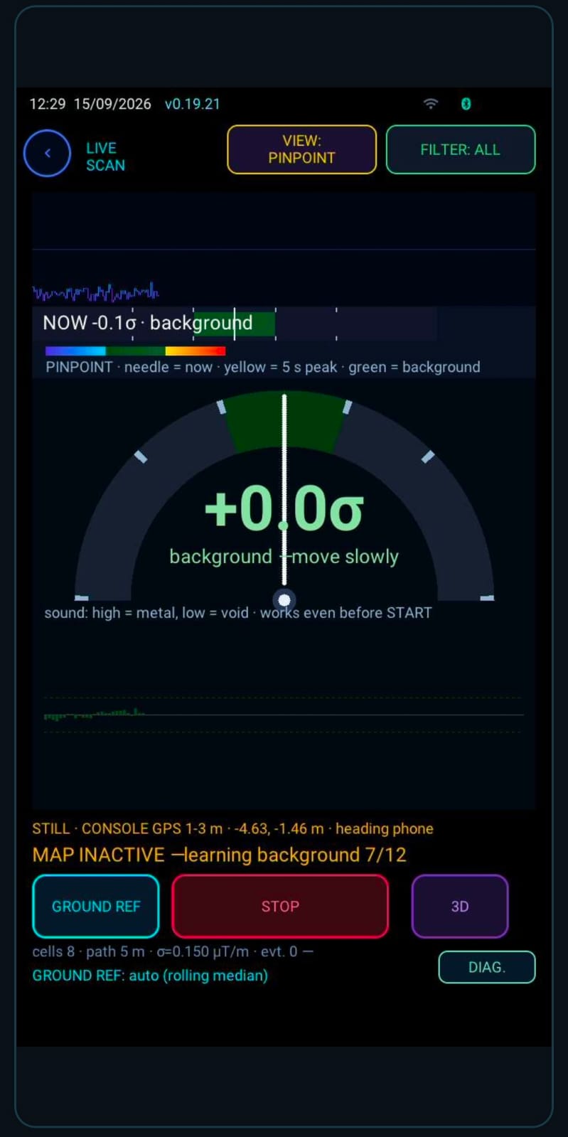
+0.0σ

PINPOINT · needle = now · yellow = 5 s peak

  • 2 × magnetometers Gradiometer on a 50 cm vertical baseline
  • 5″ touchscreen 720 × 1280, built for outdoor use
  • 3 modes Grid · Free scan · Pinpoint
  • Voice + screen An AI supervisor that guides every step
SCREENS FROM THE APP

The NOETIC console, screen by screen

Nine real console screens — from the home screen and scan setup to the map, 3D and live scanning.
Home screen
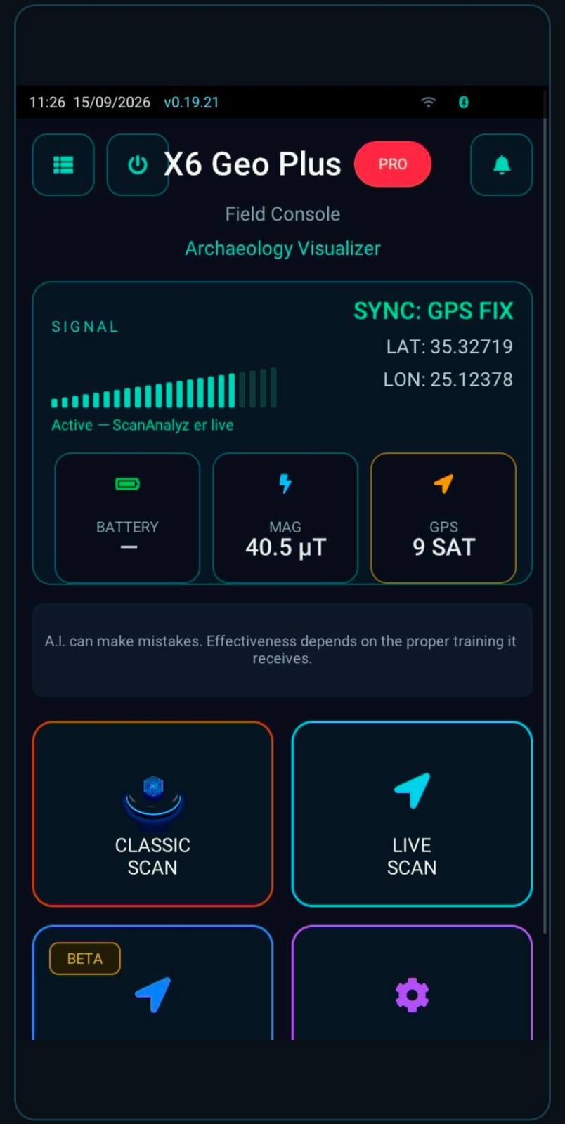
HOME Home screen Signal, GPS fix with coordinates, magnetic field and satellites at a glance; classic or live scanning starts here.
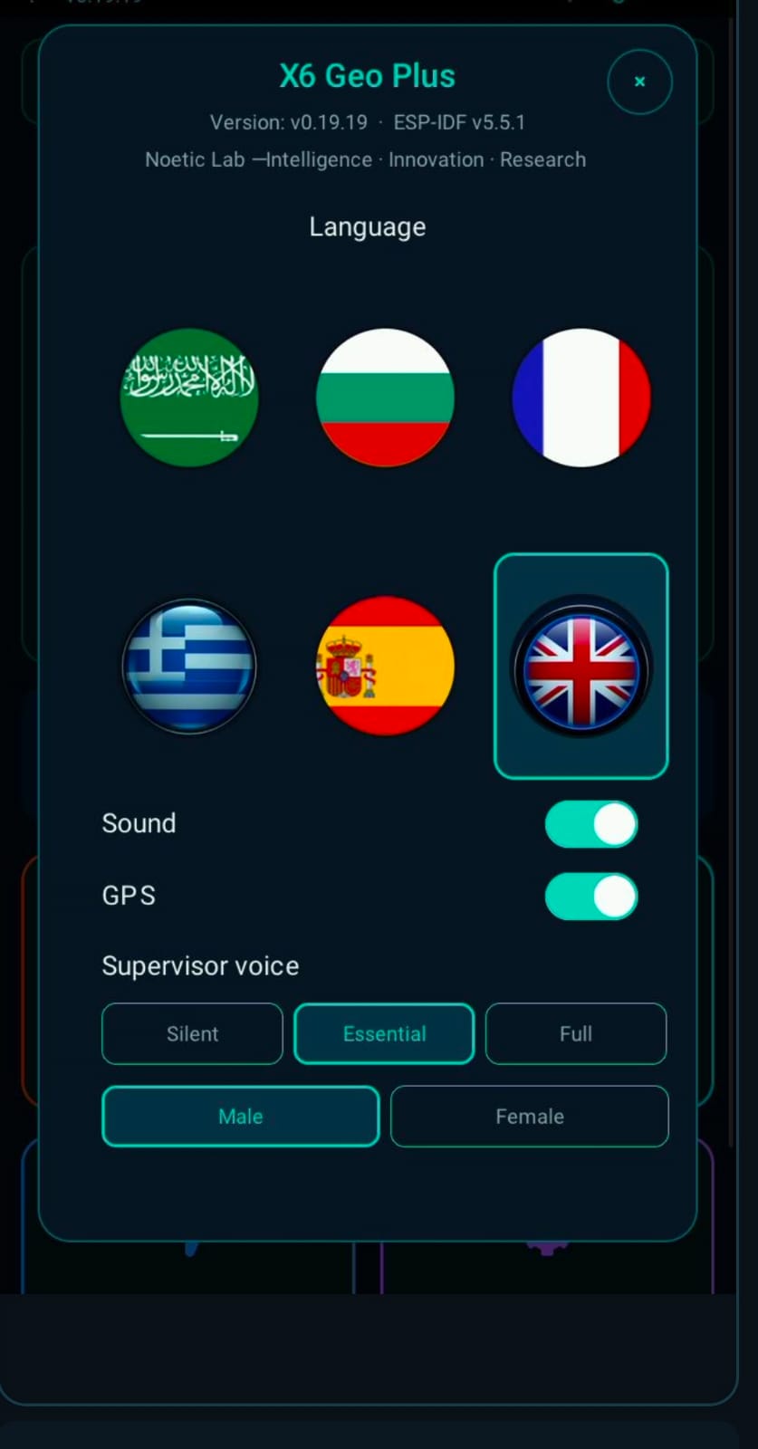
Settings & language
SETTINGS Settings & language Six languages, sound, GPS and the supervisor voice: silent, essential or full, with a male or female voice.
Grid scan setup
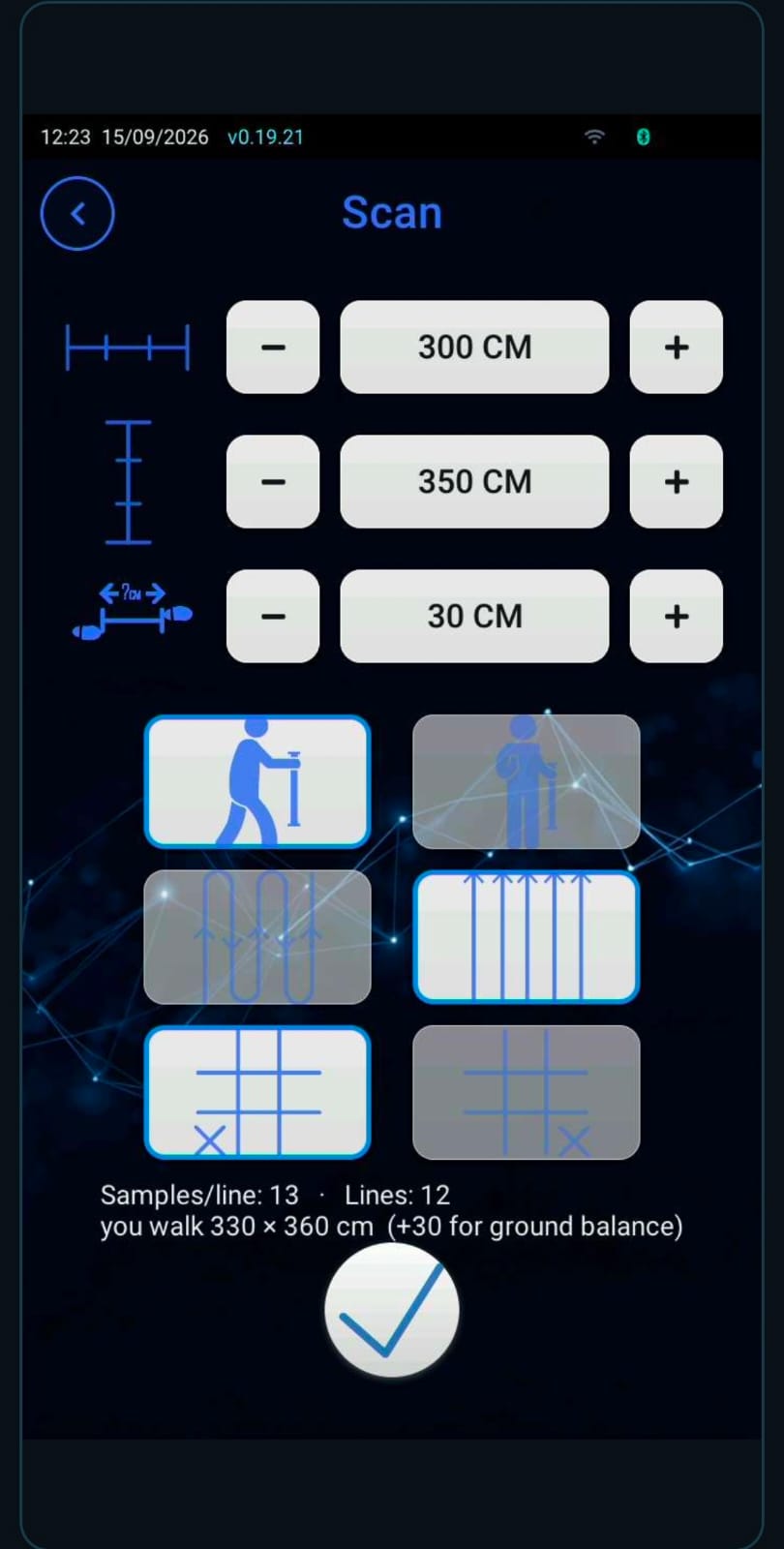
GRID SETUP Grid scan setup Width, length and step in centimetres, walking mode and path; the console works out samples, lines and the distance you will walk.
Results map
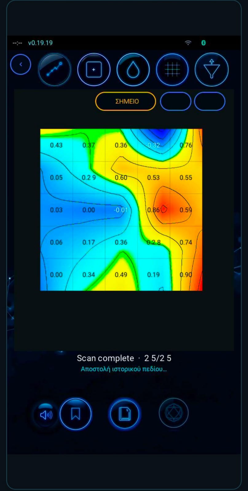
2D MAP Results map A colour map with contour lines and the value of every cell, as soon as the scan is complete.
3D surface
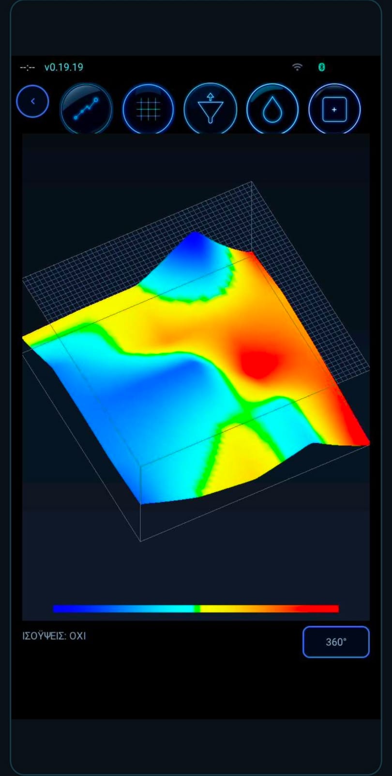
3D SURFACE 3D surface The same field as a smooth relief, with a colour scale and automatic 360° rotation.
3D grid with values
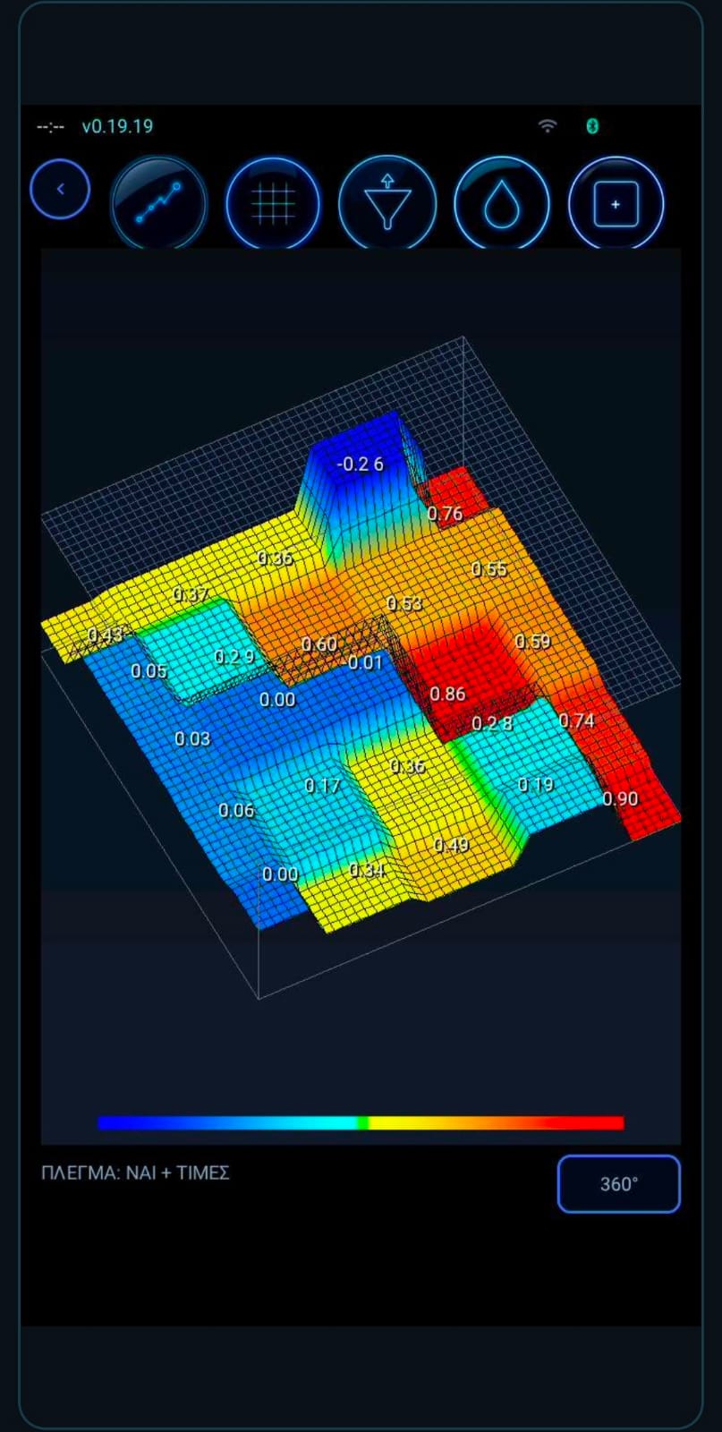
3D GRID 3D grid with values Every cell as a column with its value on top, so you can compare points precisely.
Pinpoint
PINPOINT Pinpoint A needle in sigma units with a 5-second peak and sound: high over metal, low over voids.
Live scan plan view
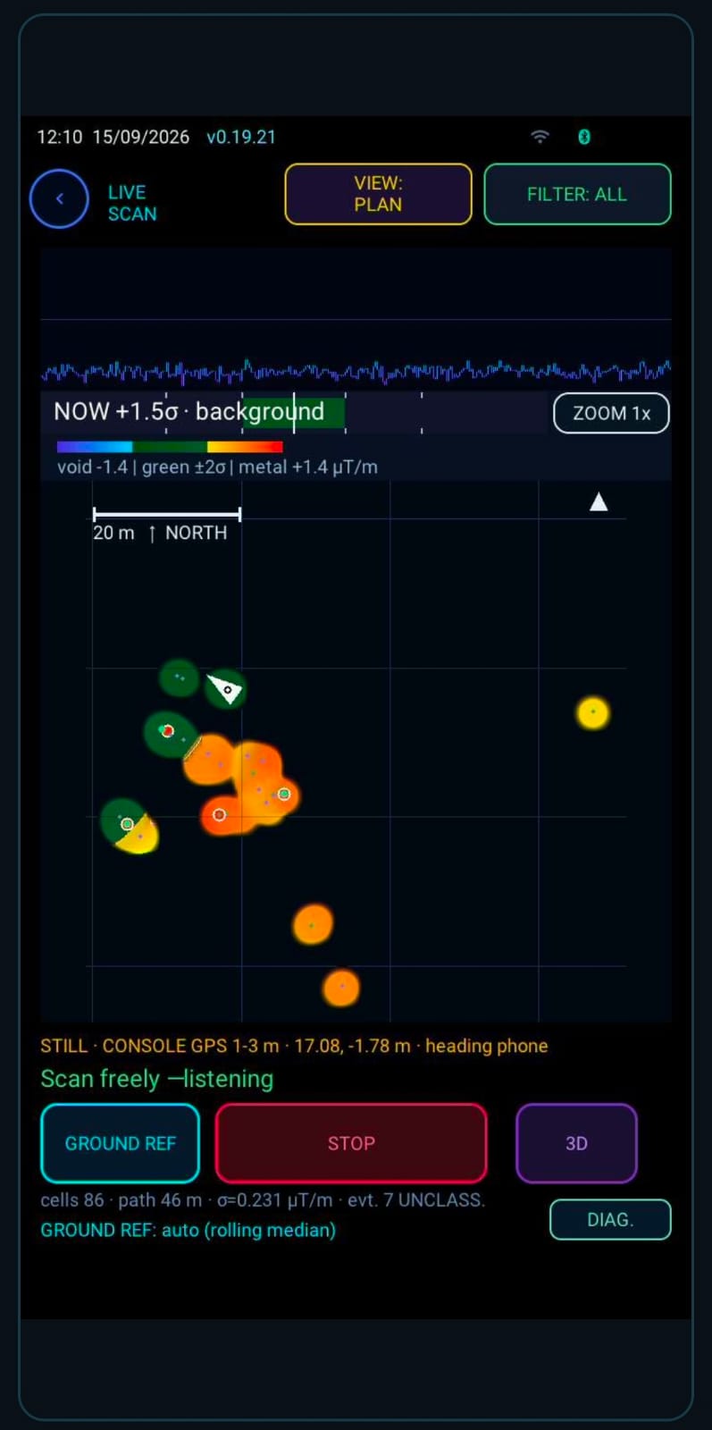
PLAN MAP Live scan plan view A north-up map with scale, where every measurement is placed by the console's GPS.
3D live
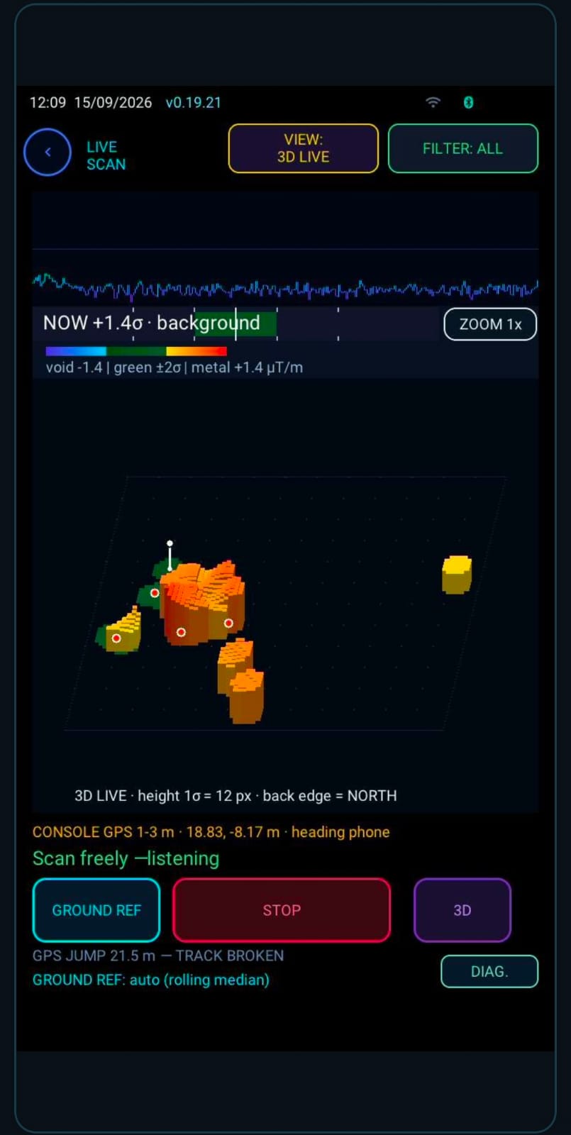
3D LIVE 3D live Anomalies rise as columns while you walk; GPS position jumps are detected and not counted as track.
CAPABILITIES

Everything a field scan needs

Designed for people in the field — not for a lab.

A true gradiometer

Two vertically separated magnetometers measure the field difference, so the background cancels out and what lies near the surface stands out.

Pinpoint by needle and sound

It holds the peak of the last 5 seconds, so you can find the centre of a target with crossing passes.

Grid scanning

Set width, length and step; the console guides you lane by lane, in parallel or zig-zag.

Free live scanning

Walk freely; every reading is placed on the map by the console's GNSS.

AI supervisor

It watches sensors, noise, GPS and battery, and speaks only when it has something measurable to say.

Obstacles without fake data

Cells you couldn't cross stay uncovered — they are never filled with neighbouring values.

Position from the console

Coordinates come from the console's GNSS receiver; position jumps are detected and never counted as distance.

Linked to your phone

Over Bluetooth the scan reaches X6 AI, together with a live screen and event photos.

LIVE SCANNING

Three ways to see the field

Switch views with a tap — measuring carries on as normal.

PINPOINT

The signal rises as you approach a target and falls as you move away. Sound works even before you start a scan.

3D LIVE

An oblique relief view: the background stays flat and only strong anomalies rise.

PLAN VIEW

A map with scale and north, your track and coloured cells — red for positive, blue for negative anomalies.

WORKFLOW

A grid scan in six steps

  1. 01

    Site check

    The console measures noise, calibration and GPS and tells you whether the site is suitable.

  2. 02

    Define the grid

    Width, length, step and walking pattern.

  3. 03

    Scan

    Cell by cell, with a sound on every reading and guidance at the end of each lane.

  4. 04

    Obstacles

    Anything you can't cross is marked with one button and stays uncovered in the file.

  5. 05

    Second pass

    Enter the height difference and the supervisor guides you to each obstacle.

  6. 06

    Send

    The scan files reach your phone for analysis in X6 AI.

AI SUPERVISOR

A second operator that never gets tired

Rules on measured quantities, with a number next to every instruction. It warns you — it doesn't decide for you.

  • Sensors, noise, GPS and battery under constant watch
  • Voice guidance at lane changes and on the second pass
  • A possible target is flagged only above the measured noise
  • Every message is recorded in the field log
SUPERVISOR

END OF LANE 3 — move to lane 4 and walk back.

RELIABILITY

Data you can trust

Locked firmware

Customer units boot signed firmware only, with encrypted memory.

Depth on the device

The estimated depth is computed on the console with a documented method, tested on a known target — never guessed by AI.

Works offline

Scanning happens in the field without internet; files move to your phone over Bluetooth.

Honest limits

The gradiometer measures magnetic anomalies; it does not identify materials. A finding is confirmed with crossing passes.

TECHNICAL DETAILS

Specifications

Device
NOETIC field console · X6 Geo Plus
Sensor
Gradiometer with two three-axis magnetometers on a 50 cm vertical baseline
Display
5″ touchscreen, 720 × 1280
Position
Built-in GNSS receiver (typically 1–3 m under open sky)
Modes
Grid scan · Free live scan · Pinpoint · Plan view · 3D
Guidance
AI supervisor with voice and on-screen instructions
Connectivity
Bluetooth Low Energy with the X6 AI app
Files
CSV · JSON · KML · field log
Security
Secure Boot and memory encryption on customer units
Screen language
Greek · English

Ready for the field?

Download X6 AI to pair the console, or contact us for a demonstration.