
Grid in centimetres
Width, length and step in cm — the app works out lines and samples.
Step-by-step grid scanning with the Ground Scanner. A voice assistant guides you, every step beeps, and at the end the app analyses the data by itself on the device: metals, voids, possible structures and soil disturbance, in 2D, 3D and 4D views.
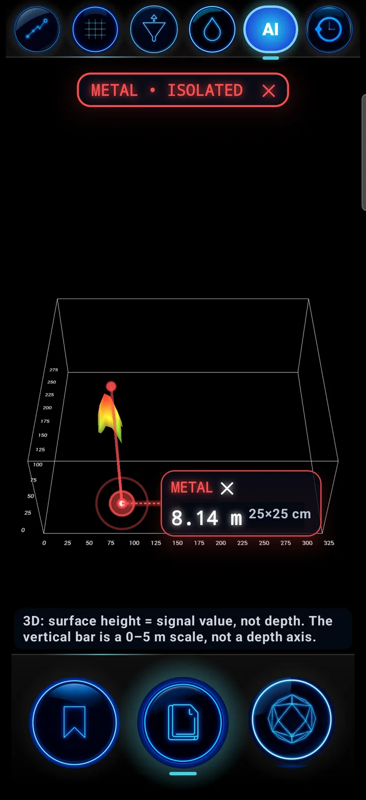
From setting up the grid to the 3D view of the findings.
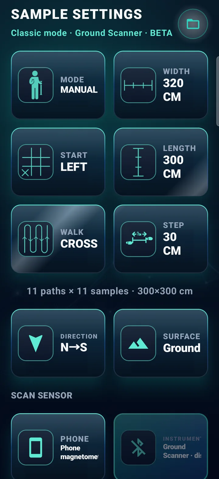
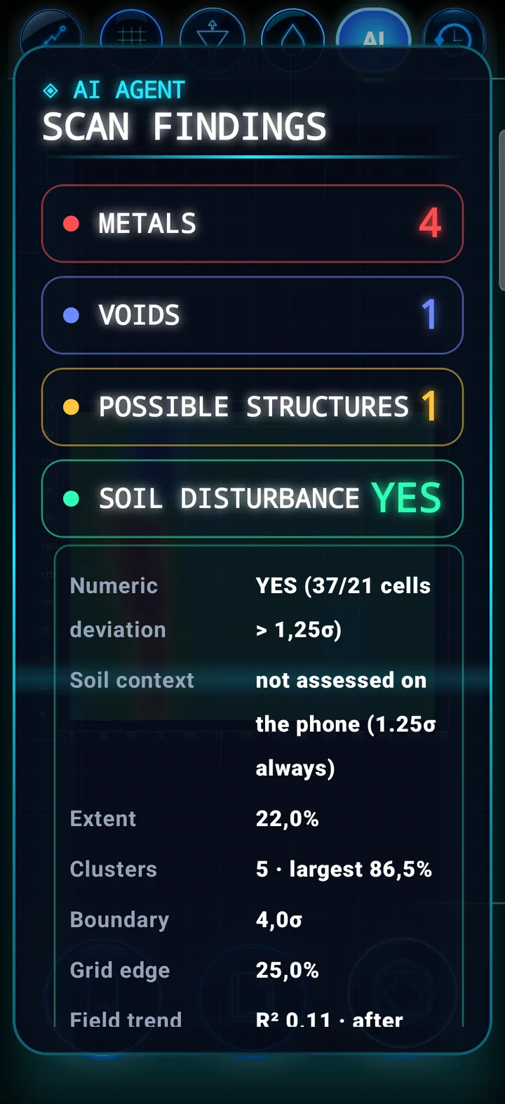
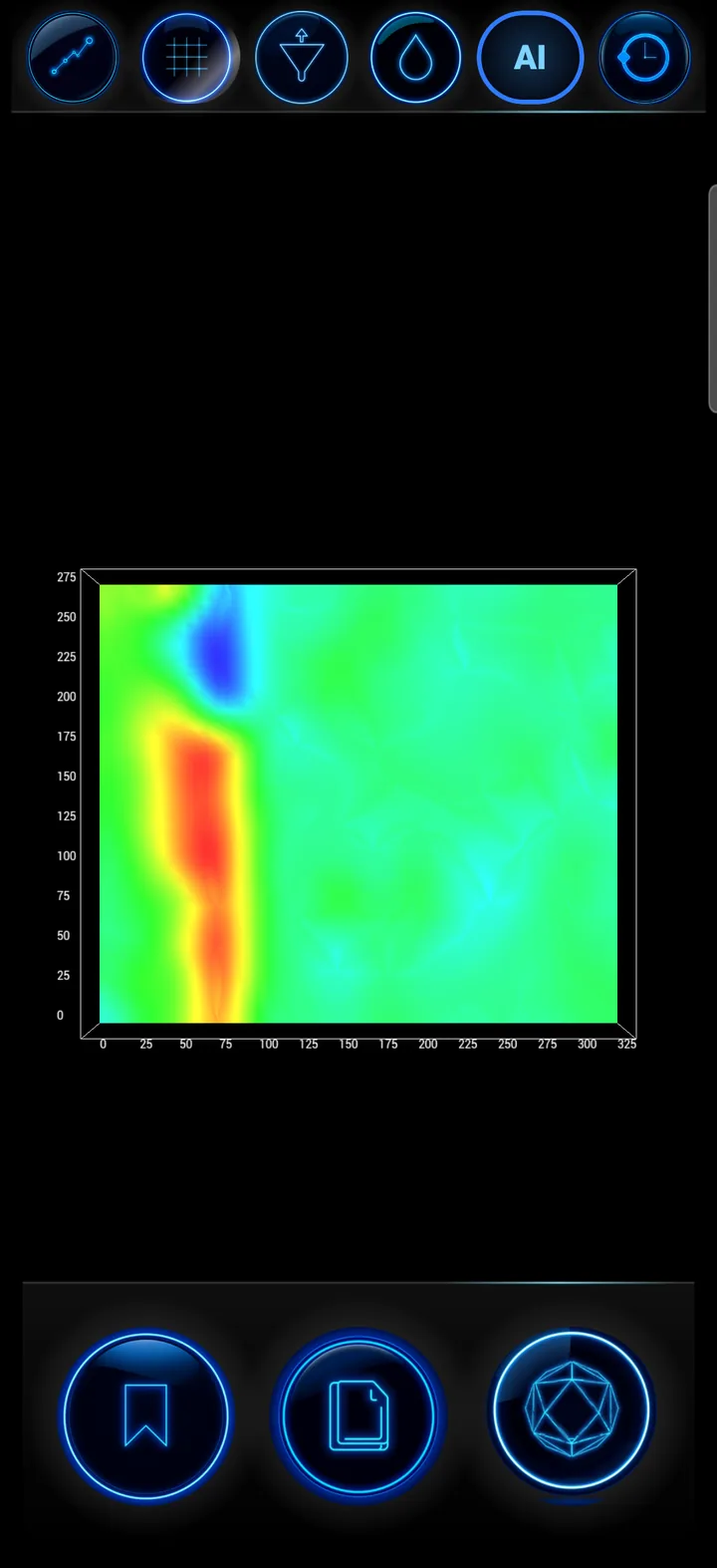
Define the grid just like in the field and start. Minimum grid: 2 lines × 2 samples.
Width, length and step in cm — the app works out lines and samples.
Start LEFT or RIGHT, walk PARALLEL or CROSS.
N→S, E→W, S→N, W→E; ground, slope or wall.
Each step from the app button or the instrument button, or automatic mode.
Reads the instrument data with a connection indicator; a phone-magnetometer flow is also available.
If something interrupts the scan, continue where you left off — or discard it.
Real-time OpenGL graphics while you scan.
CSV, XLSX, XLS, ODS, XML, JSON, KML, GPX, ZIP — regular grids open in the Classic view, others in VOXEL.
In the style of the NOETIC console: short phrases in Greek or English, following the app language, and a beep on every step.
Scan started. Line 1.
The tone is 800 Hz at normal readings, rises up to 2400 Hz as the deviation grows and falls down to 300 Hz when it drops. While the assistant speaks, the beep is lowered.
The analysis looks only for what matters in the field. For every finding it shows X/Y position, extent, peak value, estimated depth with its source, and the rule that detected it.
A strong point-like anomaly. Inside a disturbance zone it stands out only if it clearly exceeds the zone around it.
An area with consistently lower values than its surroundings.
A coherent structure with a visible outline — straight lines and right angles — shown in full.
The dug and refilled soil zone around a target, from the surface down to the target.
The disturbance rule is marked as experimental in the app. When the data are not enough, the result reads “not evaluable”.
A void or structure resting on the first row of the grid is not called a finding: it is shown separately, because at the edge there are no surroundings to compare with.
Every finding has a pin and a short callout beside the point; “Show only this” or “Show all” with one tap.
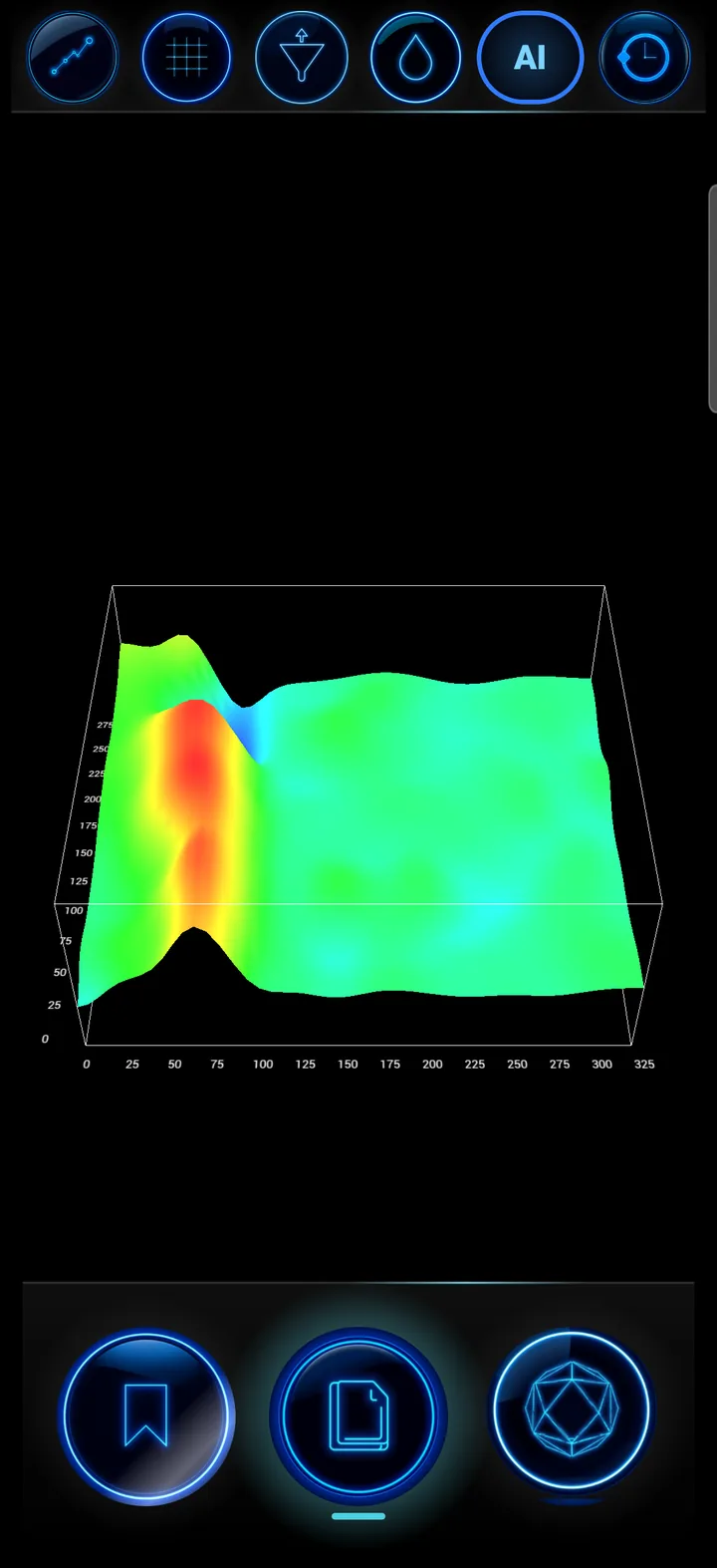
Interpolated heat map with ISO contours and grid.
Height is the signal value, not depth — stated on the screen too.
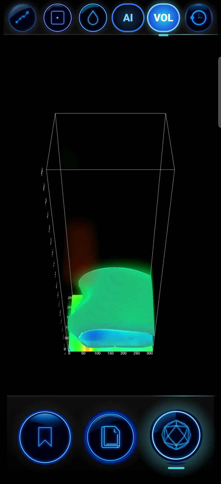
Volume built from the real data; finding boxes are a display convention.
No “invented” bodies: hidden cells become transparent instead of being filled with made-up values.
Everything is saved automatically on the phone and opens in every tool of the app.
Grid CSV, X64D file, XML and a PNG image in the “Download/X6 AI 4D” folder.
Each file records the phone position and its source — or “unavailable”, never invented.
Find any scan at a glance; NOETIC console scans also open in the Classic 2D/3D/4D view.
One tap to AI Chat, VOXEL, AR 3D X-RAY or X6 GEO-SAT.
PDF reports are written in Greek or English, as selected in the app.
Open scans in CSV, Excel, ODS, XML, JSON, KML, GPX or ZIP and view them the same way.
Switch on the Ground Scanner and pair it over Bluetooth.
Size, step, start side, walking pattern and direction.
Step by step with beeps and voice guidance.
At the end the app finds the findings by itself.
Pins, callouts and 2D/3D/4D views.
Files, PDFs, or continue in AI Chat and VOXEL.
The automatic analysis runs on the phone, offline and free of charge. For cloud analysis, send the scan to AI Chat.
Clear statistical rules, not a “black box”: every finding shows the rule that produced it.
The feature is in BETA and the disturbance rule is marked as experimental — never hidden.
It uses Android text-to-speech; a female voice where one is installed on the phone.
Manuals, example scans and presentations for AI Scan.
Download the app, connect the Ground Scanner and hear your scan “speak”.